Leeds Bradford International Airport (LBA)
City Orientation and Maps
(Leeds, England)
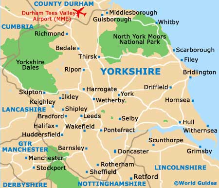
The city of Leeds is located in the county of West Yorkshire, on the northern side of England. Cities and towns close to Leeds include Bolton, Manchester, Pemberton and Liverpool, all of which lie to the south-west. Closer by, Wakefield, Barnsley and Doncaster can be found to the south of Leeds, while Harrowgate sits to the north, with Bradford and Queensbury to the west, nearby Leeds Bradford International Airport (LBA).
Leeds is full of energy and the heart of the city is lined with pedestrianised streets and full of shops, eateries and Victorian architecture, being particularly close to the canal. Also worth noting, Leeds is home to the second-largest financial centre in the whole of England, after London.
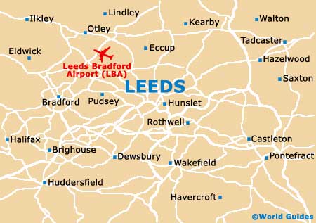
Leeds Bradford International Airport (LBA) Maps: Important City Districts
The city centre stands alongside the northern bank of the River Aire / Leeds and Liverpool Canal, and features a number of waterfront attractions. Both the bus station and train station can be found in the centre of Leeds, with the city's two universities being located on the north-western side.
The 'Gateway to Yorkshire' tourist information centre is situated within the train station and provides all of the usual leaflets, maps and assistance that you would expect, while the post office can be found on City Square.
England Map

Yorkshire Map
Leeds Map